

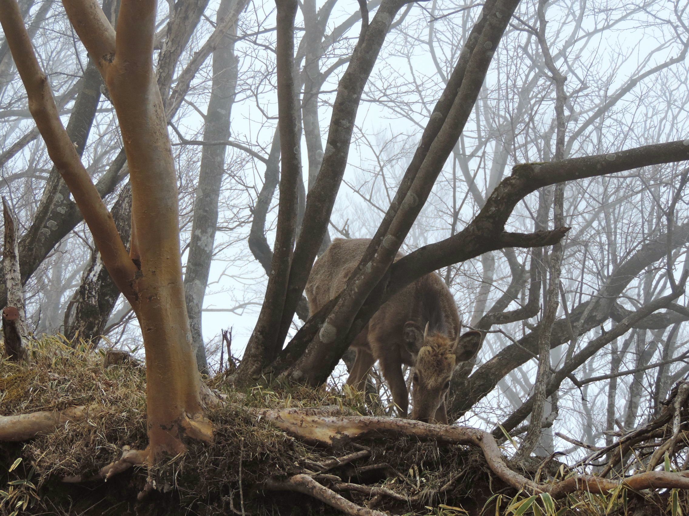
Deer take the path of least resistance to water sources. Native Americans created trails by following the deer tracks, winding their way up and down the mountainside, following the contours of the terrain. When trappers and mountain men arrived in the rocky West, they used the same trails, which are used today and maintained by America’s National Park Service.
However, in Japan, there are few wild deer. Only people. So in the days of old, when pilgrims decided to climb a mountain, there were no deer trails. In man’s great wisdom, they hoofed straight up and straight down the mountain, the shortest distance between two points.
Maybe we could learn something from deer.
Case in point: the trails leading through the Tanzawa Mountain Range in Kanagawa.
In the northwest section of Kanagawa Prefecture, the wilderness area surrounding Mount Tanzawa is a hidden treasure the locals are keeping to themselves. Outdoor enthusiasts are more familiar with nearby Hakone, one of the most visited national parks in Japan. However, to get away from the hoards of ojiisan, obaasan and gaijin in the densely forested hills of Hakone, the locals head to rugged Tanzawa. The web of trails, oftentimes steep staircases, are meticulously maintained, and rise above the tree line, providing a panoramic view of the foothills of Fuji.
Frequented by seasoned trail-runners and day-trippers alike, the recommended trailhead starts at the scenic Okura Park. Parking is available, or take the Odawara Express from Shinjuku to Shibusawa Station, and then hop on a 10-minute bus-ride to Okura. From the parking area, walk north up the road for 10 minutes until you reach the sign for Mount To-no-take.
An excellent practice hike for Fuji, it is a grueling 7km trek to the top of To-no-take (1,491m), with an elevation change of 1,200m. Depending on your itinerary, most hikers choose to stay overnight at the clean, warm and friendly confines of the Sonbutsu-sanso lodge. Call ahead (in Japanese) so the proprietors can arrange a private sleeping area.
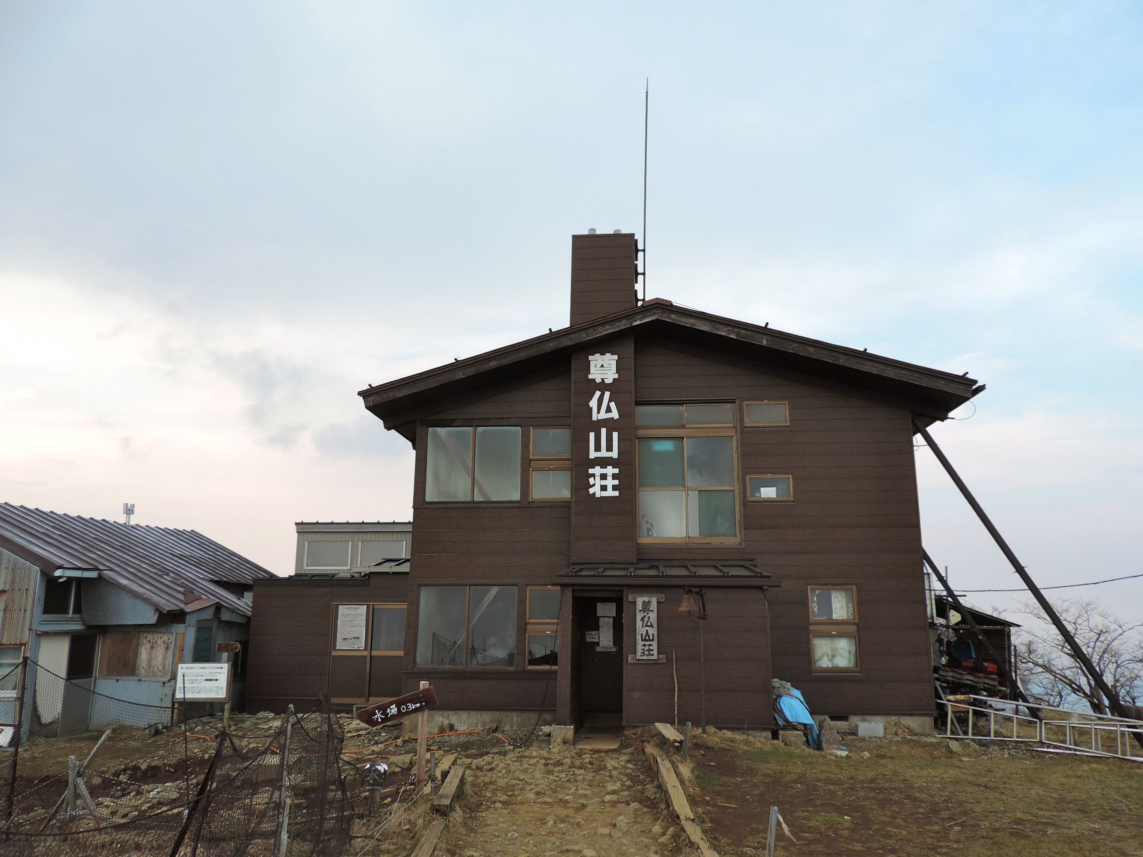
Be sure to fill up water bottles at the spring at To-no-take. From here, the only opportunity to procure water until reaching civilization is at the mountaintop lodges, which sell 200ml bottles for ¥400 or 2 liter bottles for ¥1,200.
Less-seasoned hikers stay at Sonbutsu-sanso overnight and wake up early to watch sunrise from the stadium seating at the summit (see picture above). They then make the 70-minute hike to the peak of Mount Tanzawa (1,567m), turn around and head back to Okura.
More intrepid hikers and trail-runners-in-training continue past Tanzawa, head deeper into the mountain range, encountering nary a soul during the two-hour trek to the top of Mount Hirugatake (1,673m), the highest point in the Tanzawa Mountain Range.
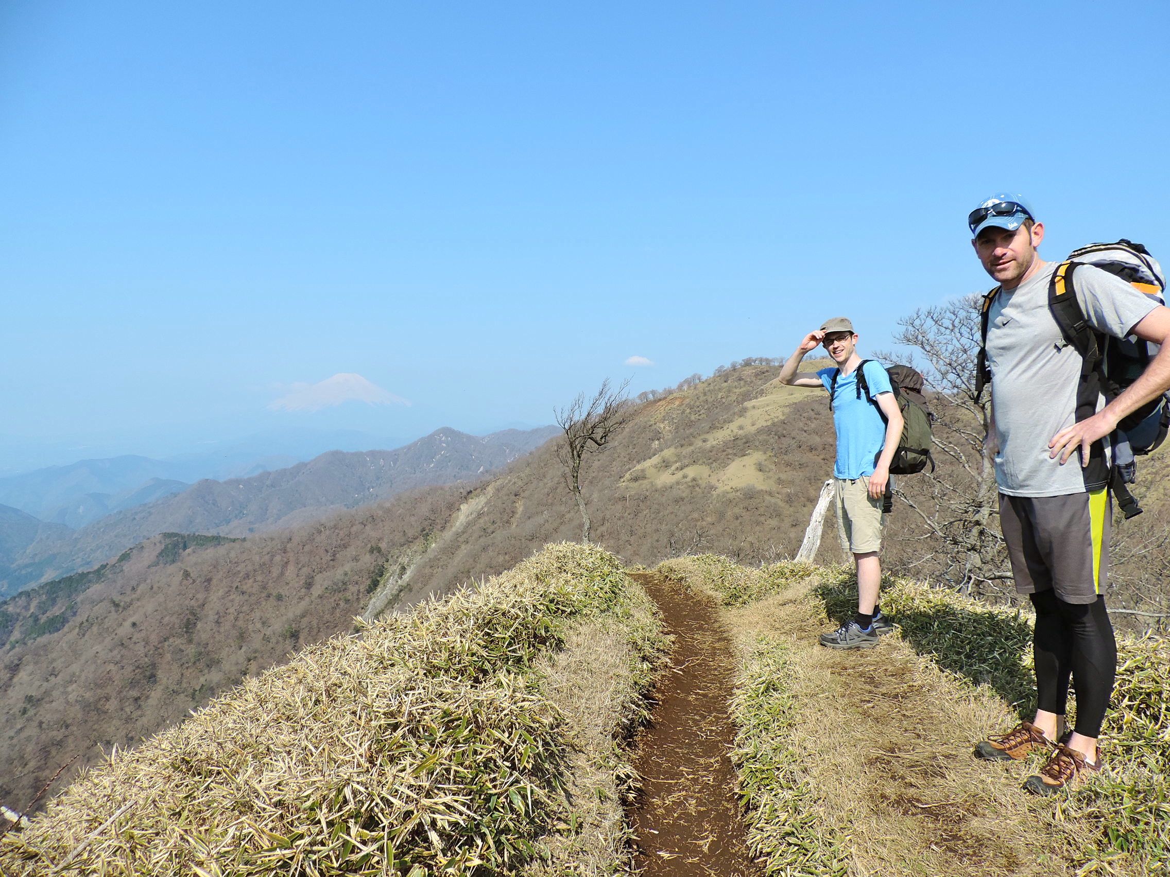
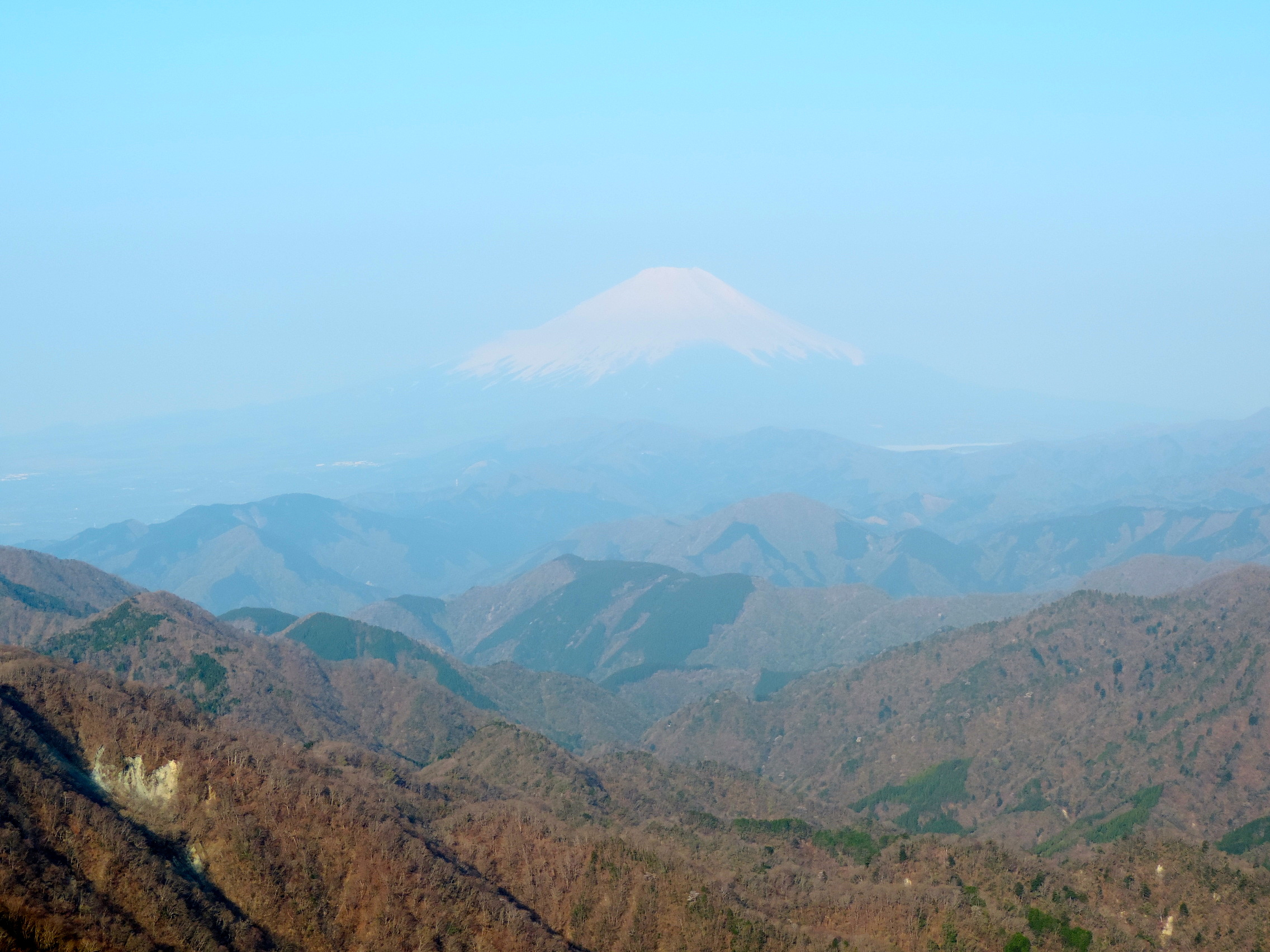
The trail follows the ridgeline the entire way, a steep climb that allows for a continuous view of Mount Fuji on the left and Lake Miyagase on the right.
The 70-minute western descent from Hirugatake is quite intense, and at times hikers are required to scramble down rock faces using the chains and ropes provided. As soon as hikers reach the bottom of the gorge, it is time to head back uphill to the summit of Mount Hinokimaramaru (1,601m).
One of the niceties the caretakers of the trail provide are scenic and well-maintained picnic spots strategically posted along the route. The moment a winded hiker feels the urge to take a rest, one of these picnic spots with its wooden tables emerges from the bush.
From Hinokimaramaru, it’s a 1,500m knee-knocking descent back to civilization, where you begin running into families and fresh day-hikers clogging up the trail. The 17km trek on day two ends at the bus stop at Nishi-Tanzawa Shizen Kyoshitsu. Overnight parking is available, otherwise it is a 70-minute bus ride to Shin-Matsuda Station on the Odakyu Line.
The 24km trail (which I discovered in my Lonely Planet’s Hiking in Japan guidebook) is not for beginners. Those training for a trail run will find it a nice break from Hakone, and the steep inclines provide excellent practice opportunities. Moderate hikers will find the trail to be a good challenge that provides gorgeous views and less crowds.
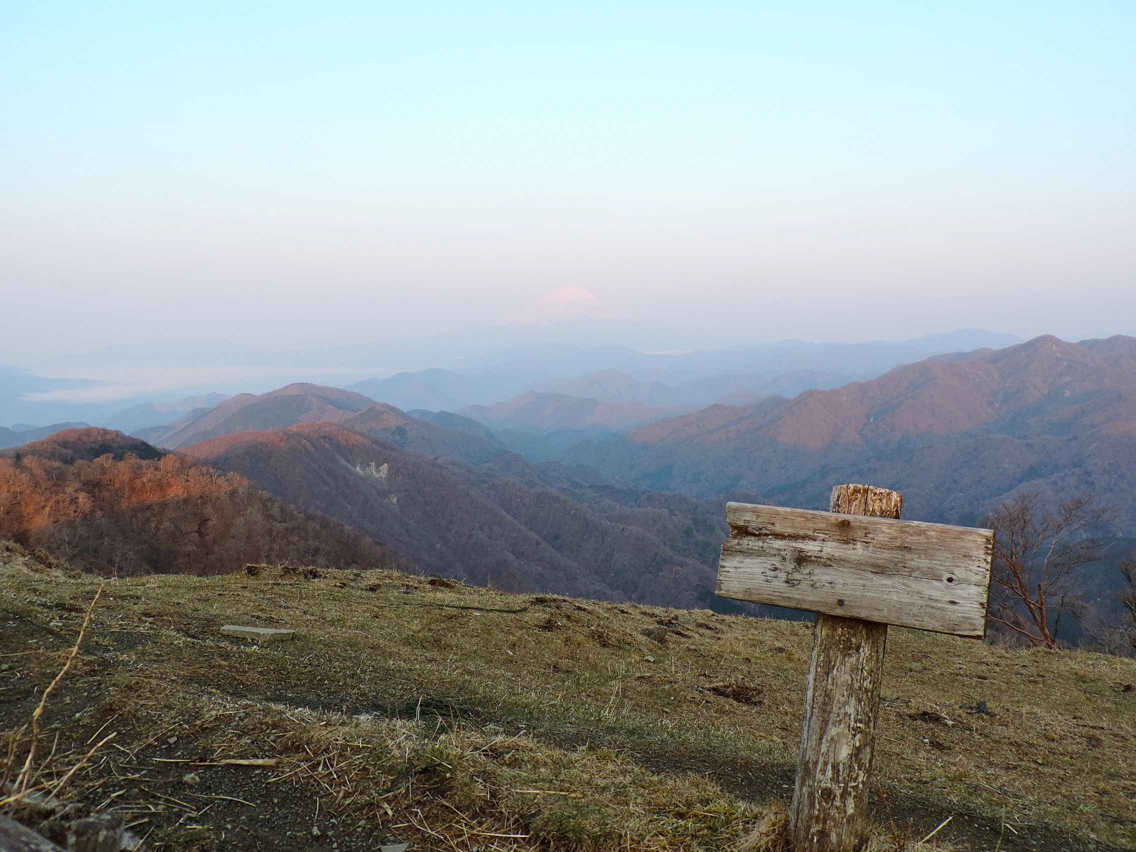
While planning your hike to Tanzawa, there is very little information available in English. However, the signs on the well-marked trail all include English directions, which is rare in other prefectures.

One response to “Mount Tanzawa”
[…] hiking is not cute. Mount Tanzawa is a two-day hike. The first day is 7km straight up and then on day two we head 10km, peaking just […]